


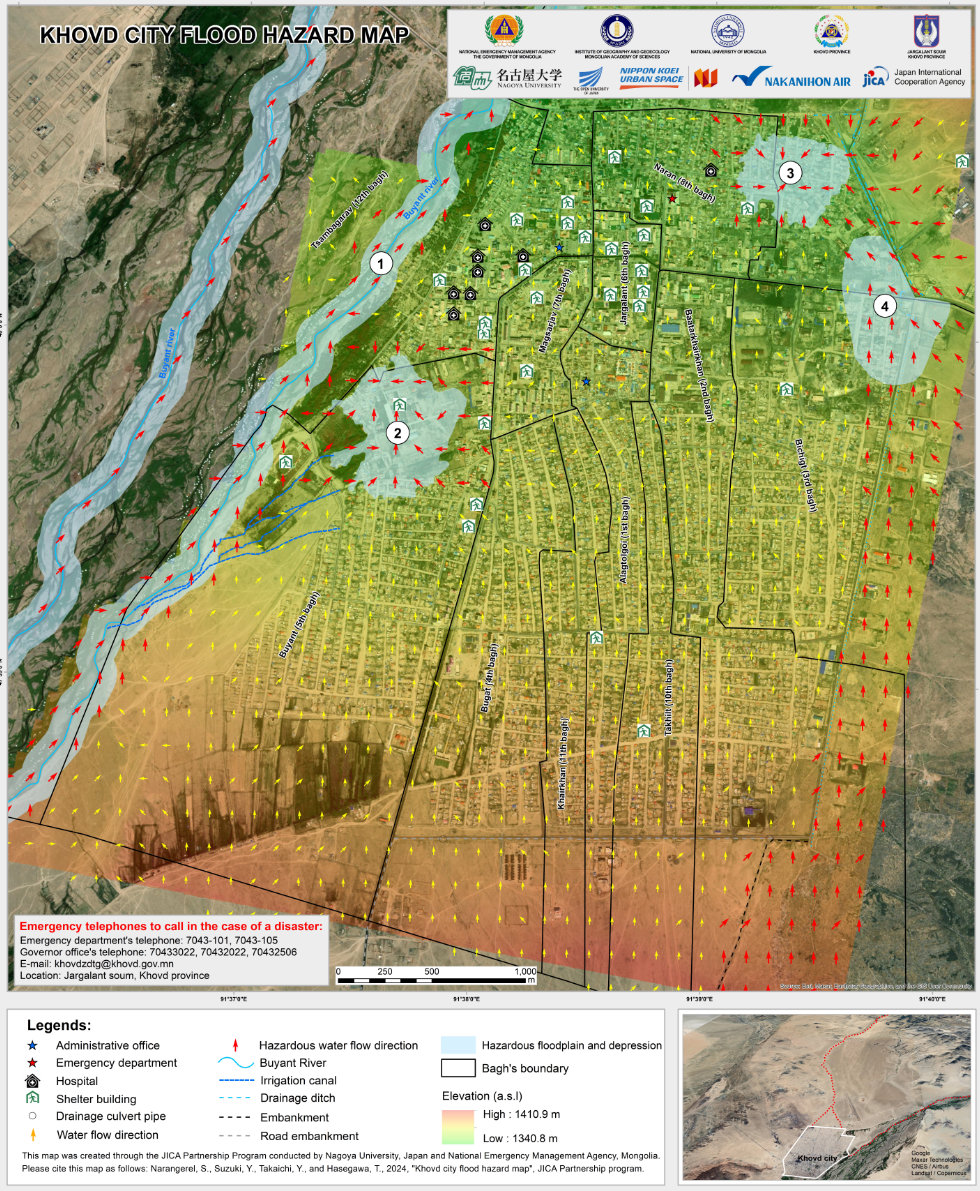
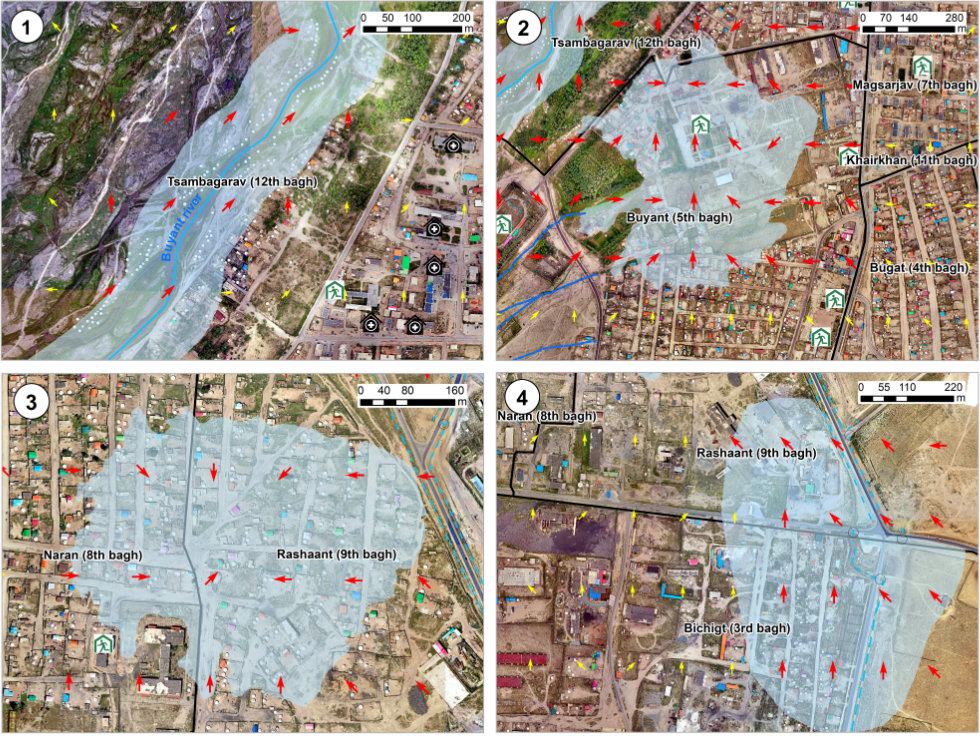
The image on the upper left is a flood hazard map based on the detailed topographical map measured by a drone, showing water flow directions (arrow) and facilities related to countermeasures.
Red arrows indicate the possible higher flood risk because of following reasons.
- ① Floodplain and flood water comes along the Buyant River;
- ② Water concentrates in depressions from irrigation canals;
- ③ Water concentrates in depressions from the dry valley and gully;
- ④ Water flows along the outside of the road embankment and overflows near drainage ditches;
1994 and 2022 floods (Landsat satellite images)
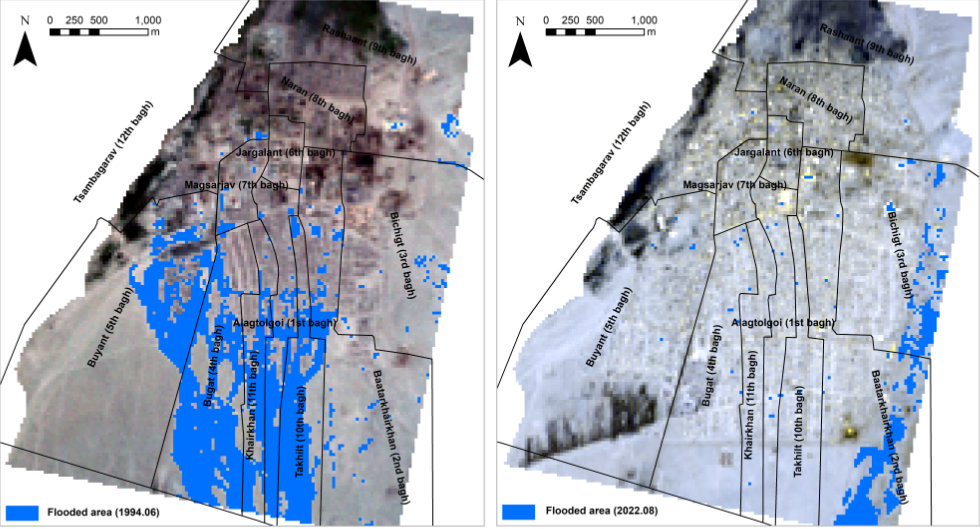
In 1994, flood waters entered the city of Khovd directly from the south.
After that flood, an artificial embankment was built upstream, moving the flood flow path eastward.
However,
the enbankments are weak and could be destroyed if heavy rains intensify due to global warming, leading to another flood similar to 1994.
Avoid staying these areas during floods and evacuate to safer places or buildings.