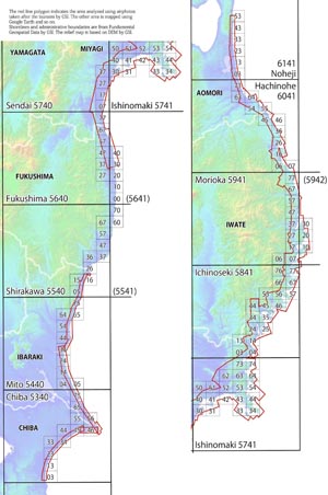
Maps of the Area hit by the Tsunami of 11 March 2011,
Northeast Japan
Northeast Japan
by Tsunami Damage Mapping Team, Association of Japanese Geographers
|
Tsunami damage area maps with scale of 1:25,000 were made by interpretation of the aerial photographs taken just after the earthquake by Geospatial Information Authority of Japan. No-photo areas are mapped using Google Earth and so on. The purpose of this mapping is to promptly provide basic information about extent of tsunami invasion and distribution of devastated area for the all people taking counter-measures against the disaster. Red line indicates limit of tsunami invasion, and portion colored blue shows heavily damaged residential area. You can check our data on the |
e-mail: tohoku.tsunami.map@gmail.com
FAX: +81-52-788-6039
